We also offer Thermal Imagery services for the roofing and energy industries. Thermal imagery can detect roofing issues unseen by conventional visual inspections.
A thermal scan of your structure can also detect hot spots associated with inefficient windows, doors or insulation.
A thermal scan of your structure can also detect hot spots associated with inefficient windows, doors or insulation.
Our aerial photography services can help show unique angles and perspectives of your property, providing revealing insights into the health of your assets. Aerial videography delivers 4k ultra HD resolution aerial inspections.
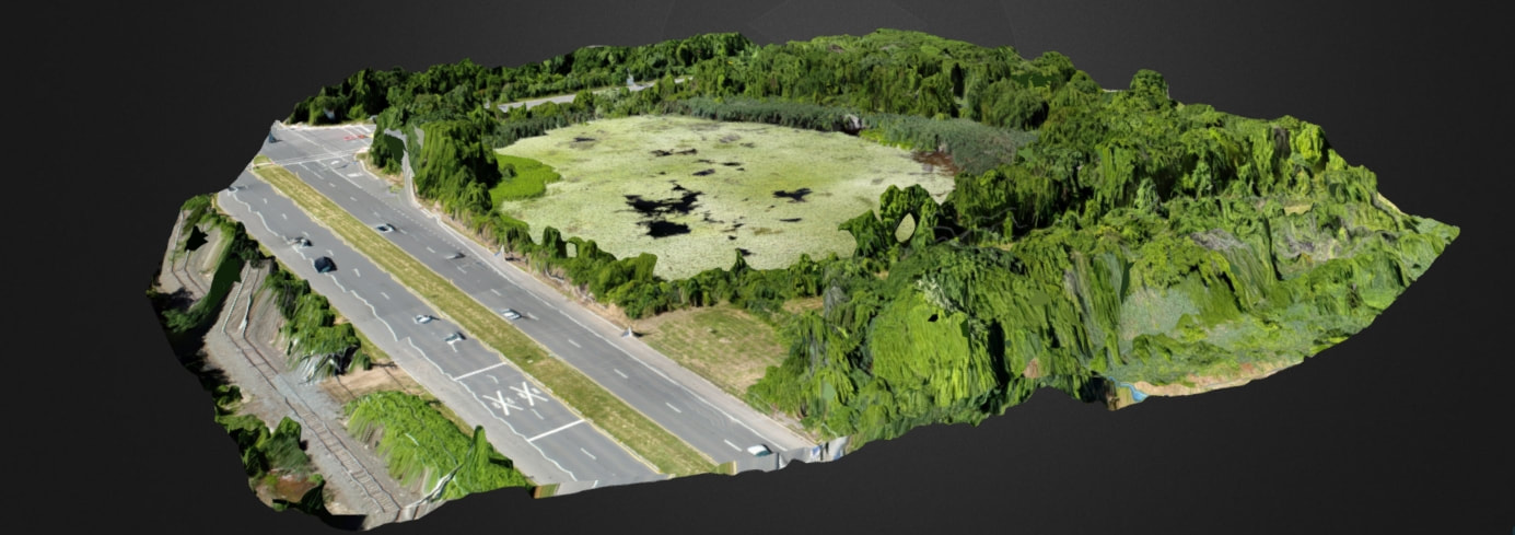
We also offer 3D mapping that can show you an interactive map of your construction site. Mapping can be done well ahead of any person actually visiting a site for pre planning and site evaluation. Perfect for inaccessible areas.
Also, 3D maps can show elevation measurements, UV exposure, plant and vegetation health and more.
Including measurement of aggregate piles.
Mapping is accurate and repeatable for time progression maps and pictures of your project from start to finish.